
Trace an Atascadero Street Directory
A useful Atascadero street directory begins with a site, not a guessed name. San Luis Obispo County assessment data can tie a street address to a parcel number, while the county map viewer can show nearby parcels and land-use layers. From there, permits, planning files, recorded instruments, and selected historical directories add different kinds of evidence. Ownership is recorded evidence. Occupancy is a narrower inference that needs a dated source. The safest workflow keeps each claim tied to the record that can actually support it.
Search the same address in more than one record system, but do not force the systems to say the same thing. The county assessor uses APNs and situs addresses. The city permit portal uses a project site. The recorder indexes parties and documents. A reverse directory may list a person at a number for one edition. This is the street-by-street sequence:
- Enter the street address or map location in the San Luis Obispo County Property Inquiry Portal, then capture the APN and the displayed situs address.
- Open the SLO County Interactive Data Viewer, identify the target parcel, and save the APNs of parcels that touch it or sit across the roadway.
- Check Atascadero eTRAKiT and planning files by site address for current or recent permits, projects, applicants, and public contacts.
- Use the APN, owner name, grant date, and document number to bridge into the Clerk-Recorder Official Records index and trace recorded transfers.
- For household clues, compare voter data only through a permitted channel and consult selected Haines/Cole, Polk, or telephone editions held in local history collections.
The result is a documented address trail rather than a claim that every person connected to the street has been found. A street directory is strongest when the source, date, and role are stated beside each conclusion.
Atascadero Street Directory Search Fields
The Property Inquiry Portal is primarily an APN and situs tool. Its public route can expose parcel facts, but it does not offer an unrestricted owner-name web search. Start with a map or site address, obtain the APN, and then inspect the parcel record. Authenticated or assigned access can add owner-name and DBA-name modes, so an ordinary public search should not be described as a name-first owner directory.
| Field or mode | Entry type | Atascadero use and limit |
|---|---|---|
| APN | Text, numbers only | Full or partial parcel key; the most durable bridge to maps, history, and documents. |
| Situs | Street number and name, with city text | Full or partial address search; use an abbreviated city when the county guide calls for it. |
| Owner Name | Full or partial name | Available in authenticated or assigned access, not an unrestricted public web mode. |
| DBA Name | Full or partial business name | Useful for a public business connection; it does not establish a residence. |
Parcel results can show current owners and shares, situs and mailing or owner addresses, values, characteristics, structures, exemption history, ownership and document chronology, and a parcel-map PDF. The OWN, HVL, DOC, and HON tabs answer different questions. A mailing address is where tax correspondence goes. A situs address is the physical parcel. Neither proves that a particular household occupies the site.
Note: Generic APN or situs terms can return more useful results than an over-detailed entry that suppresses a match.
Browse Atascadero Parcels in GIS
The free SLO County GIS viewer supports a different kind of street directory work. Zoom to an address, identify the parcel, and click adjoining shapes one at a time. The viewer can expose APNs, map links, land-use layers, owner-mailing fields, and planning-property addresses. Those fields are not interchangeable. A planning property address describes the site used by the land-use system, while an owner address generally describes tax correspondence.
GIS is especially helpful where a street bends, a lot has a rear access point, or an adjacent strip may be a recorded right-of-way. Save the APN for every parcel before moving to the next. The map is a visual research aid, not a legal survey. For a legal easement or recorded plot map, Atascadero Community Development routes researchers to the County Recorder; city planning interprets land use, while the recorder establishes the recorded instrument.
- Parcel
- A mapped assessment unit identified by an APN. One parcel is not the same thing as one home or one household.
- Situs address
- The physical location used to identify the parcel. It differs from the address chosen for tax mail.
- Plat
- A recorded map that lays out lots, streets, alleys, rights-of-way, and related designations. It helps preserve identity when street text changes.
- Criss-cross directory
- A reverse directory arranged around an address, street, or telephone entry rather than only an alphabetical surname list.
Atascadero Street Records by Address
Address-keyed sources overlap, but each has a different keeper and time range. The following map keeps address research from becoming an unsupported list of names. The parcel and permit systems are the practical current starting points; the recorder and older directories add time depth.
| Record set | Keeper | What it can show | Access |
|---|---|---|---|
| Assessment parcel | SLO County Assessor | APN, situs, mailing address, shares, values, characteristics, and maps | Property Inquiry Portal, GIS, or counter |
| GIS parcel browse | SLO County GIS and Assessor | Boundaries, adjacent shapes, land-use layers, and address fields | Free interactive viewer |
| Permits and projects | City of Atascadero Community Development | Site, permit type and status, contacts, fees, inspections, reviews, and chronology | Public eTRAKiT search; current or recent activity |
| Recorded instruments | San Luis Obispo County Clerk-Recorder | Grantor, grantee, document class, recording date, number, and deed image details | Free index, paid copies, counter, or office request |
| Voter data | California Secretary of State and County Elections | Personal status or permitted file fields, not a public street roster | Personal tool or qualified application |
The APN joins the assessment record to the map and to the assessor’s HON and DOC history. The recorder then takes a name or document number, not a street browse, so the street address must be translated into a durable parcel and party trail first. A street directory that skips that translation is most likely to miss an older address form.
The county assessment-map page explains the map route and the Atascadero counter. Its parcel-map link is useful for checking lot position before comparing an adjacent parcel.
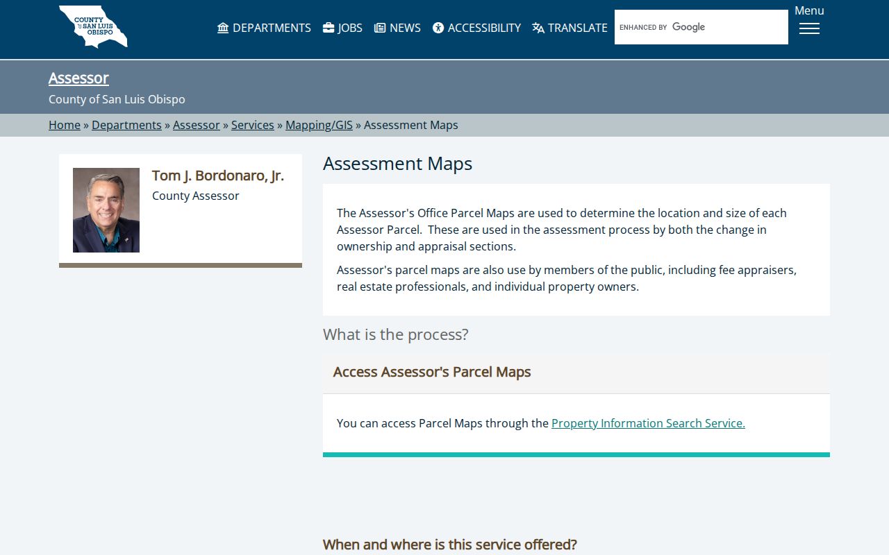
The assessment-map view reinforces the key practice: use the APN and parcel shape as the stable reference, then treat every person or address field as a dated record clue.
Atascadero Permit Trails by Site Address
Atascadero eTRAKiT provides an address-facing layer that the assessor does not. Anonymous public searches cover permits, projects, properties, registered professionals, and business licenses. A public account is useful for application and document-management features, but an account is not needed for the basic search tiles. Search the site address first, then read the result as a project record rather than a resident list.
The permit search includes a Site Address route with Street Number and Street Name fields. The portal documents operators such as Begins With, Contains, Equals, At Least, and At Most. Permit Number is the best exact key when known; Permit Type, Status, and a date range can narrow results where the live mode offers them.
The Atascadero eTRAKiT search page shows the city’s permit and property entry points.
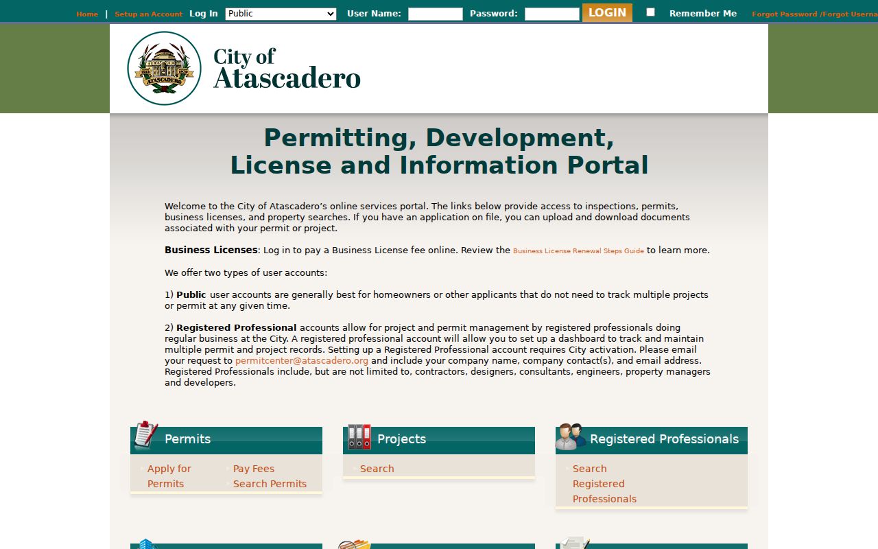
A sample record, OTCR19-0123 at 6500 Palma, displayed Permit Info, Site Info, Contacts, Fees, Inspections, Chronology, Conditions, Reviews, and statuses including APPROVED, ISSUED, and FINALED. Those fields can date work and identify an applicant or professional. They do not prove who occupied the property.
Use the city’s planning documents and resources when a project has an exact address but no useful permit result. The planning layer can name a project and its public participants, which gives a street directory a second official route without turning a project file into a household claim.
Planning Files Add Atascadero Project Names
Planning documents are valuable when a street search is about how a site changed. The city’s environmental-document table can include an Environmental Document Number, State Clearinghouse Number, Document Type, Project Name, City Project Number, Address, and Applicant or Representative. That combination connects an exact site to a public project file and helps distinguish a parcel from a nearby road or a paper right-of-way.
The planning page is also a source-link trail for project addresses along El Camino Real, Del Rio, and other corridors. Read the address as a site identifier. An applicant, consultant, or owner named in a public file is a participant in that file, not automatically an occupant or neighbor.
Atascadero planning documents and resources provide the address-specific project context.
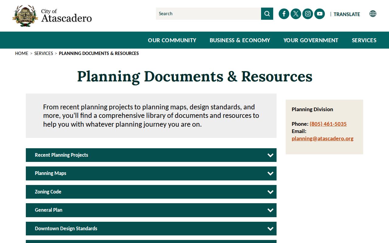
The planning image belongs beside the parcel workflow because an exact project address can confirm which public file to request, while the parcel and deed records still carry the title history.
Atascadero’s predesigned ADU instruction adds a practical address check: an accessory unit uses the primary dwelling’s number with “Unit B.” Search both the base number and the unit suffix when a parcel or permit result appears incomplete.
The city’s public-record request form accepts a description, date, subject, and title, with categories for building, business, planning, police, fire, or other records. The city states a ten-day determination rule and a possible written extension of up to fourteen additional days for unusual circumstances. Copy charges are $0.50 for the first page and $0.10 for each additional page. Identified records are held for two weeks after an availability notice.
Note: A city project address can identify a public file, but it does not establish who occupied the completed property.
Turn an Atascadero Address Into a Deed Chain
The San Luis Obispo County Official Records Search is not a street directory in the narrow sense. It is a party and document index. Search modes include Name, Document Number, Document Type, Map Book/Page, Advanced, and recording-date start and end fields. Use the APN and current owner as the bridge, then search the recorded party and document number rather than relying on an old street spelling.
The online name and document index reaches from 1923 forward. County recorded holdings reach back to 1850, while downloadable images begin August 8, 2001. The web search is free, and eligible images can be placed in a cart after login. Earlier copies require an office or mail request. The Clerk-Recorder lists (805) 781-5080 for help, and a copy request is strongest when it supplies the document number or book and page together with the associated name.
A deed image can add the legal description, vesting language, signatures, notary block, and transfer clues that a basic index omits. The recorder’s office is the place to resolve an older instrument or a map reference. A street directory becomes much more reliable when the legal description stays attached to each name change.
Note: The recorder index identifies a recorded instrument; the image and legal description are needed before treating a party as part of a parcel history.
The Atascadero Addressing Quirk
Atascadero’s historical address language can change without the parcel changing. A local Simpson example describes a service station at South State Highway and The Mall in a 1950 Polk listing, then gives 6490 El Camino Real in 1954. A 1953 entry uses “S state hway,” while later editions shift the trade name and the numbered address. The same site is also connected to a proprietor name, a nickname, classified wording, and a 1960 telephone listing.
This is why a resilient street directory searches personal and classified sections, business and trade names, route descriptions, and modern numbers. No official citywide grid or mass-renumbering year was located. The absence of a published renumbering date is itself a reason to preserve the old wording instead of replacing it with a guessed modern form.
Carry the APN, subdivision or legal description, parcel map, permit chronology, photographs, and any Sanborn or aerial reference while testing a change. The durable question is whether the land description and parcel position match. Street text alone is too brittle for a long address trail.
Atascadero Reverse Directories by Year
Haines and Cole samples provide a useful reverse-directory layer for 1975, 1980, 1984, 1990, 1995, 1999, 2003, 2008, and 2013. They can connect a street number to a listed occupant or business for the edition year. The gaps matter. These are sampled editions, not proof of a continuous run or a complete household count.
Older evidence comes from selected R. L. Polk editions cited for 1946 through 1958 and a verified Pacific Telephone volume from 1960. Polk entries can place a proprietor, occupation, intersection, or business at an older address. The library’s Local History Collection and yearbooks add context, while the Atascadero city directory collections page is the better place to compare publishers and shelf access.
The Atascadero Library at 6555 Capistrano Avenue, (805) 461-6161, is the local starting point for North County history books and yearbooks. Posted branch hours are Tuesday and Wednesday 10 to 6, Thursday 9 to 5, Friday 1 to 5, and Saturday 9 to 5; the branch is closed Sunday and Monday. Check the county library locations listing before visiting.
Read each listing with its abbreviation key and edition date. A listed person may be an occupant, proprietor, or contact, and an omitted person may still have lived there. Pair a directory entry with a deed, census page, permit, obituary, or newspaper item before making a household claim.
Limits of an Atascadero Street Directory
No street directory can identify every person connected to an address. Non-owner household members, guests, utility customers, delivery accounts, and DMV addresses are not an open street list. An owner mailing address can belong to an absentee owner, trust, business, or manager. A permit contact can be a contractor or design professional. Keep those roles separate.
California’s My Voter Status tool is a personal verification service, not a public by-name directory. The public voter file is controlled by Elections Code sections 2180 through 2194. Permitted political, election, scholarly, journalistic, and governmental uses require the proper application and purpose. Section 18109 makes knowing unauthorized acquisition or use a misdemeanor. The file does not disclose ballot choices.
Lawful use. Atascadero address records support personal, lawful research such as property history, genealogy, and civic review. Penal Code section 646.9 and Code of Civil Procedure section 527.6 address stalking and civil harassment; public records are not permission to threaten, repeatedly contact, or harm anyone.
Protected residents may be absent from ordinary results. California’s Safe at Home program supplies a substitute mailing address for eligible participants, although a property bought in a participant’s own name can still reveal a legal location. A missing record can reflect confidentiality, access limits, a name variant, or an incomplete collection. It should not be treated as proof of absence.